

Please click text below
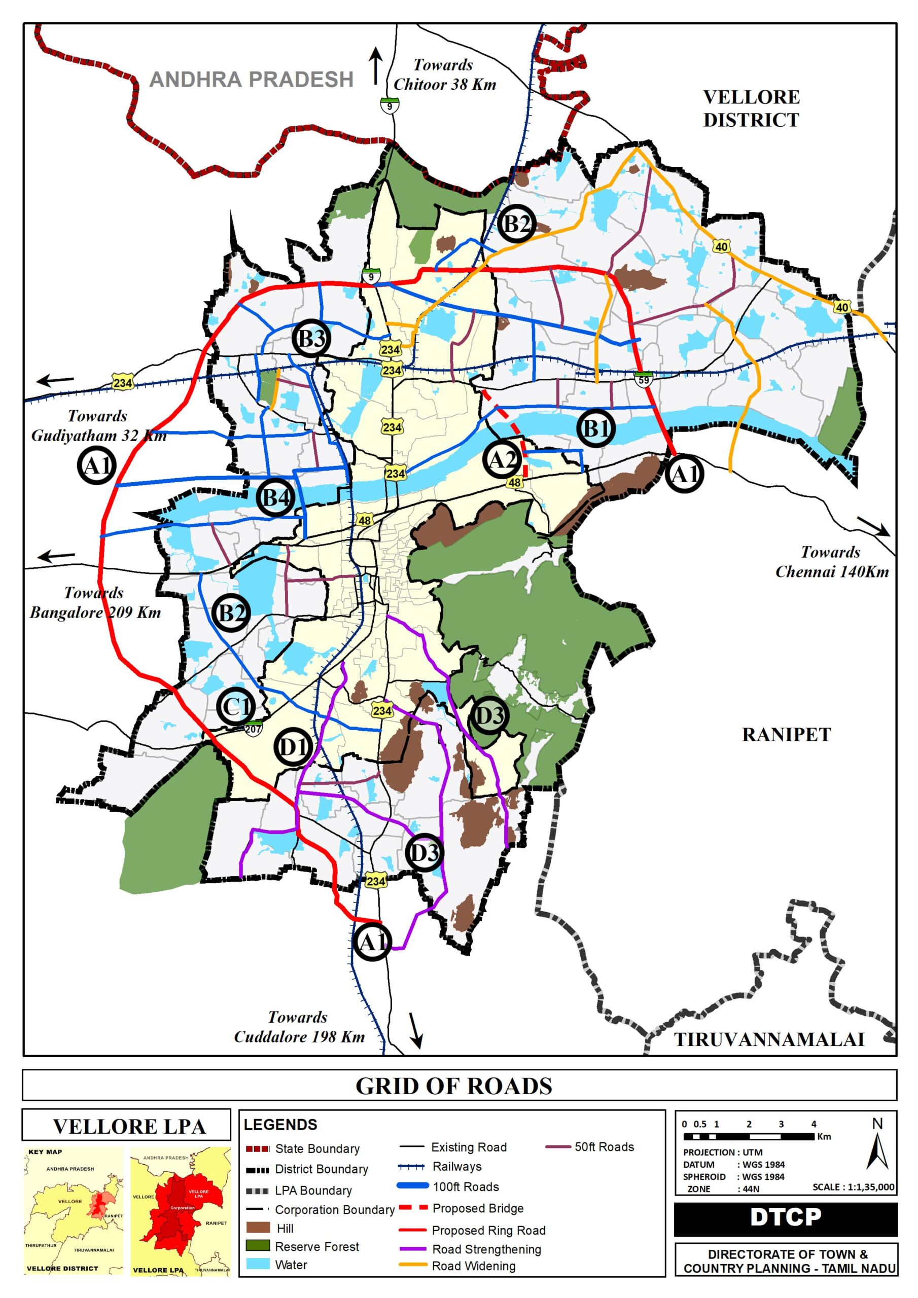
The proposed Grid of Road network aims to enhance connectivity, reduce traffic congestion, and support the overall growth and sustainability of the region.
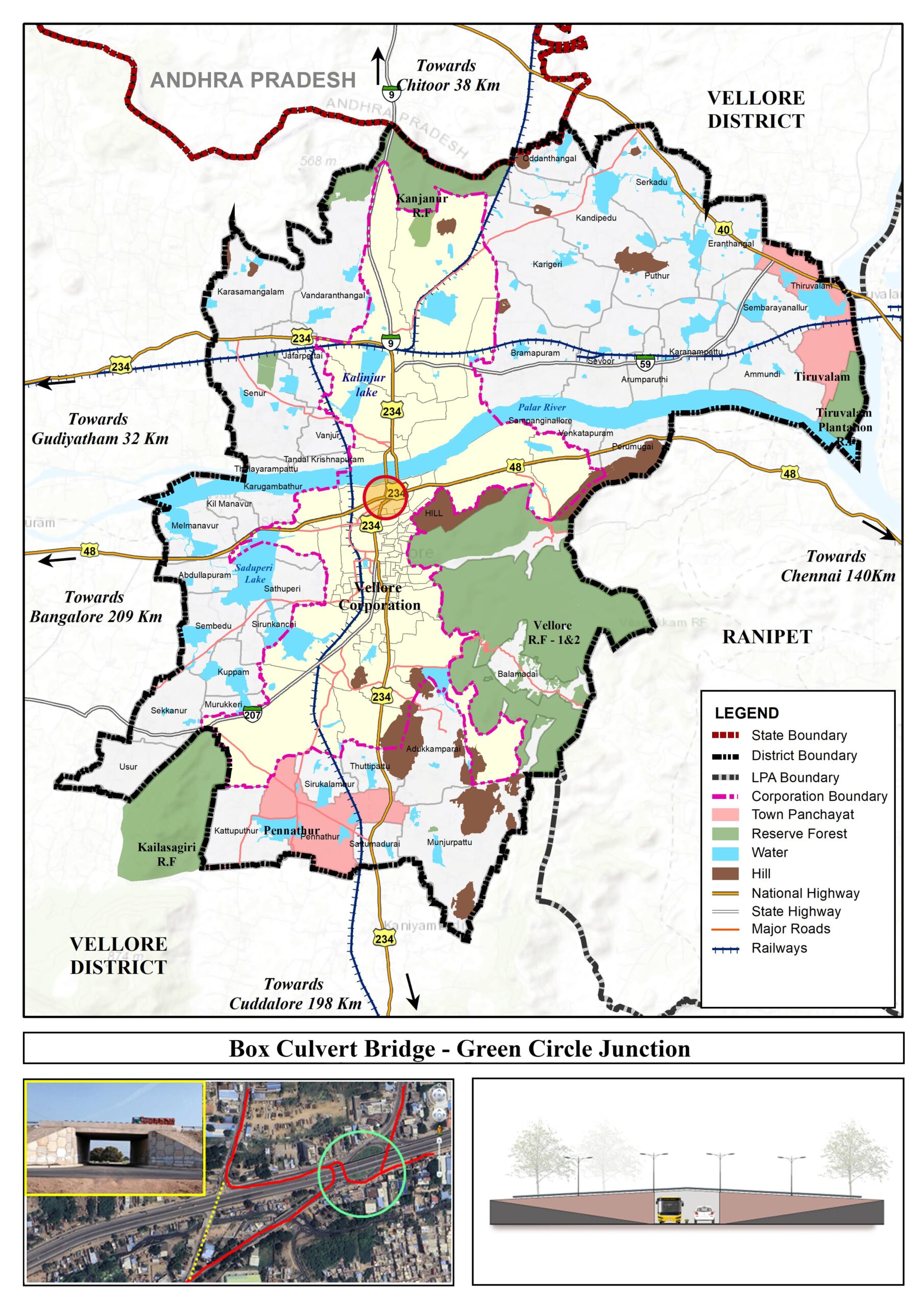
The bridge proposal not only serves as a vital transportation link but also connects the missing link of the major transportation network from Katpadi to Vellore.
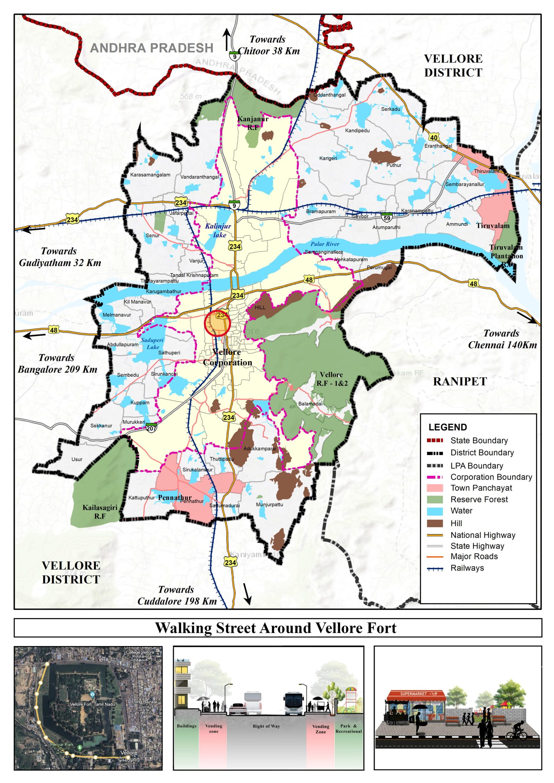
The Walking Street proposal aims to transform a designated area into a lively and accessible space, fostering community engagement, supporting local businesses, and enhancing the overall urban experience.
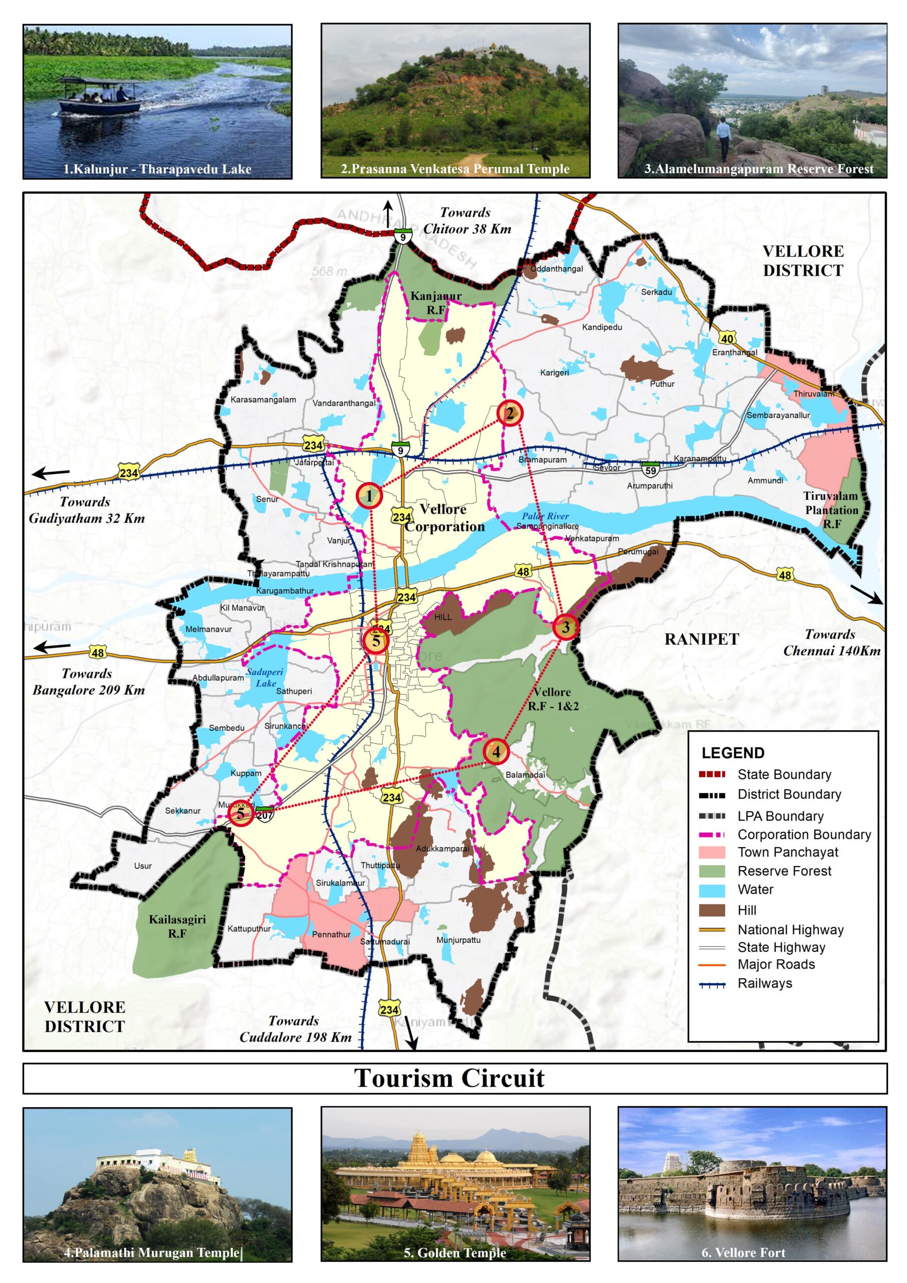
This proposal outlines a sustainable tourism circuit designed to showcase the cultural, historical, and natural richness of the Vellore Local Planning Area.
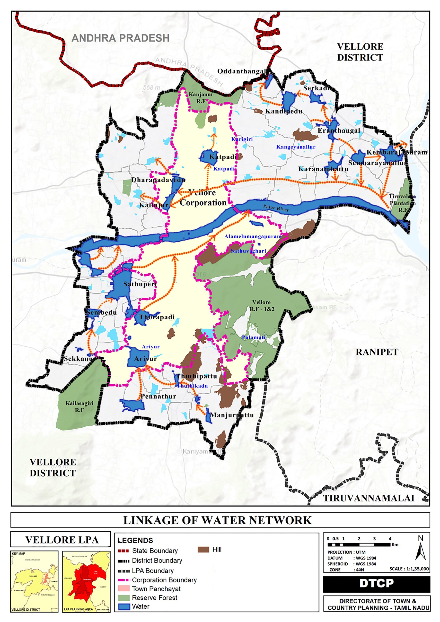
Linking water tanks involves connecting multiple storage units to create a comprehensive water distribution system. This practice is vital for optimizing water supply, ensuring consistent access, and managing resources efficiently. Whether in residential, commercial, or agricultural settings, the linking of water tanks offers several advantages.
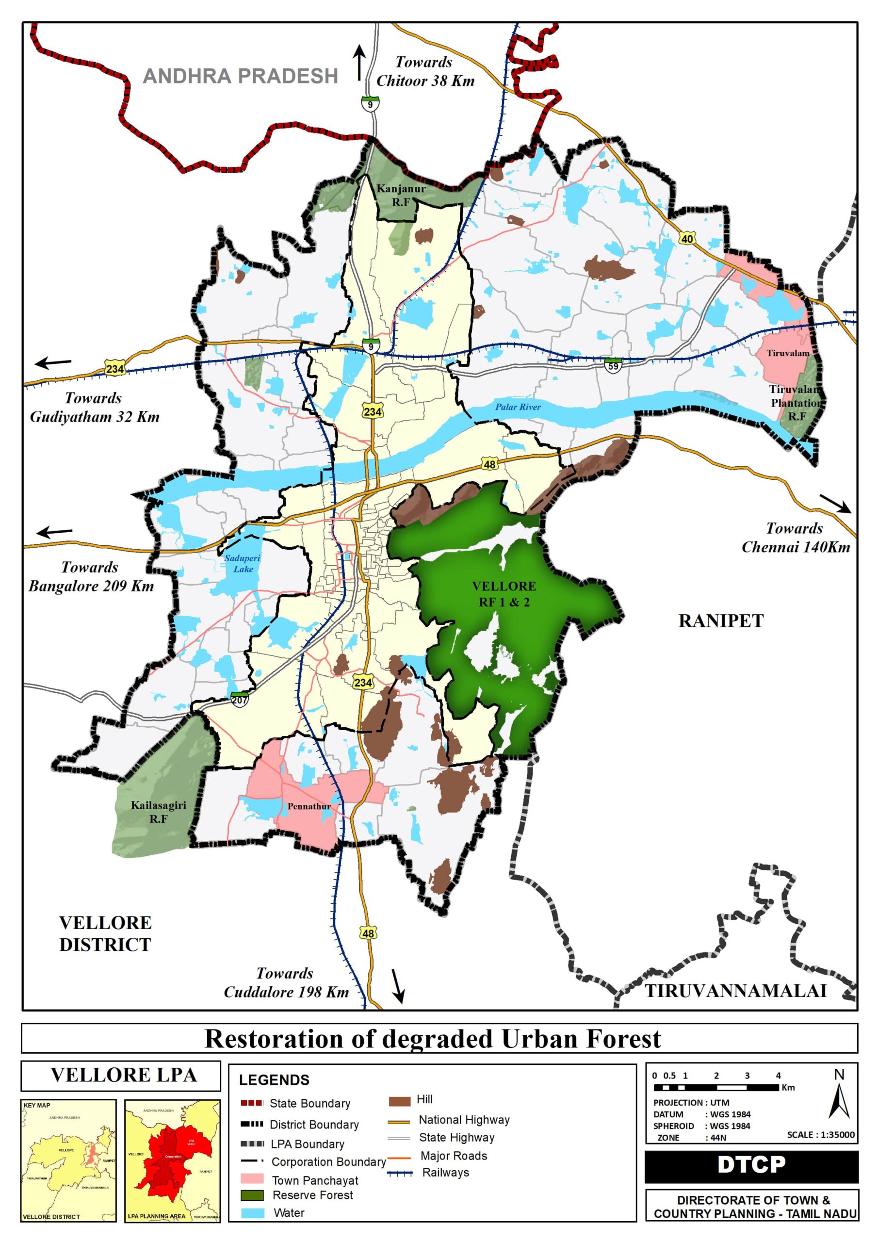
The afforestation of degraded urban forest in Vellore aims to rejuvenate the ecological health of the forest, enhance biodiversity, and create a sustainable green space for the community.
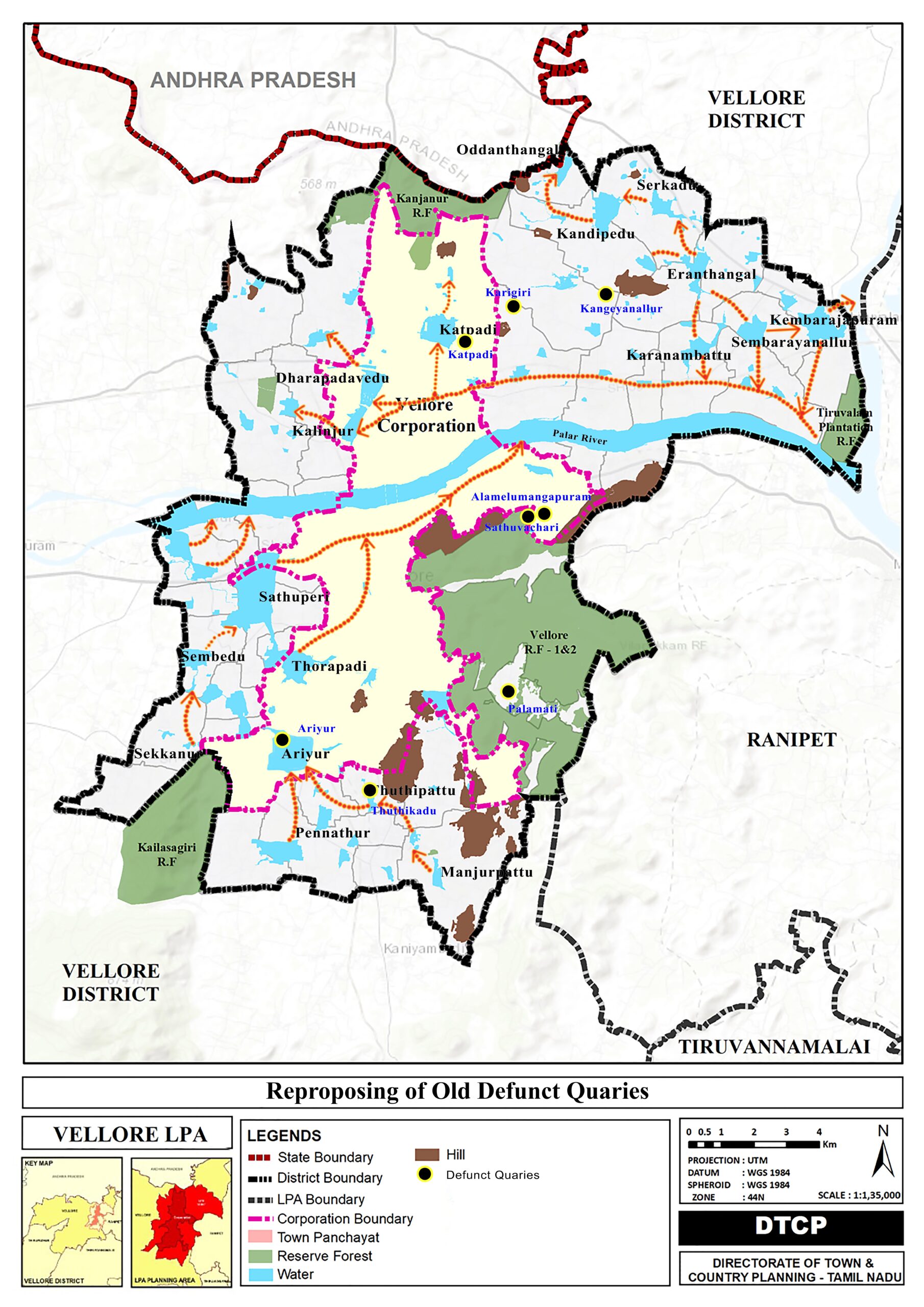
Repurposing old defunct quarries presents an opportunity to transform abandoned sites into valuable and sustainable assets. These Quarries are proposed as water storage reservoirs.
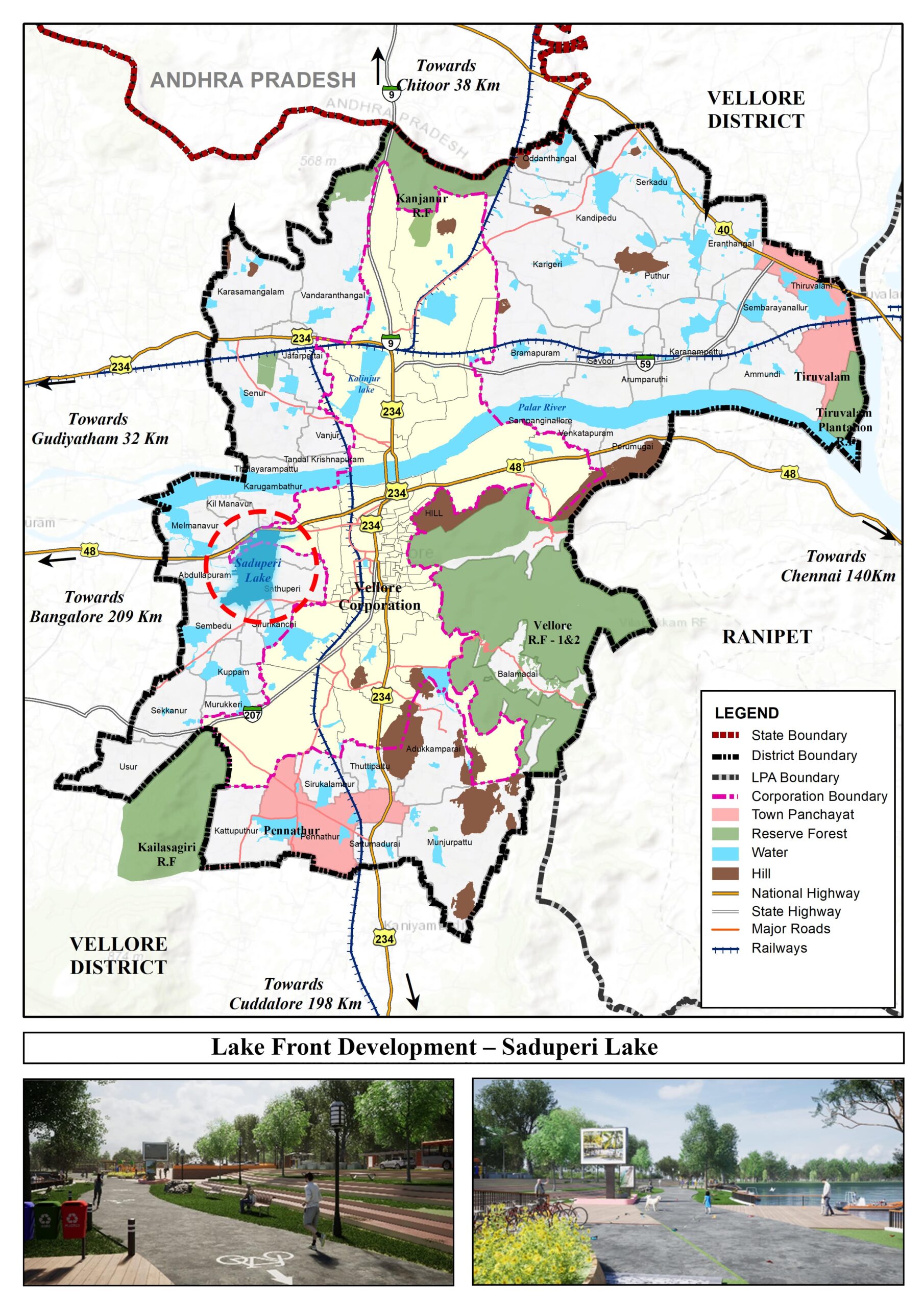
Saduperi Lakefront Development is proposed to conserve the lake and create a recreational opportunity in the neighborhood.
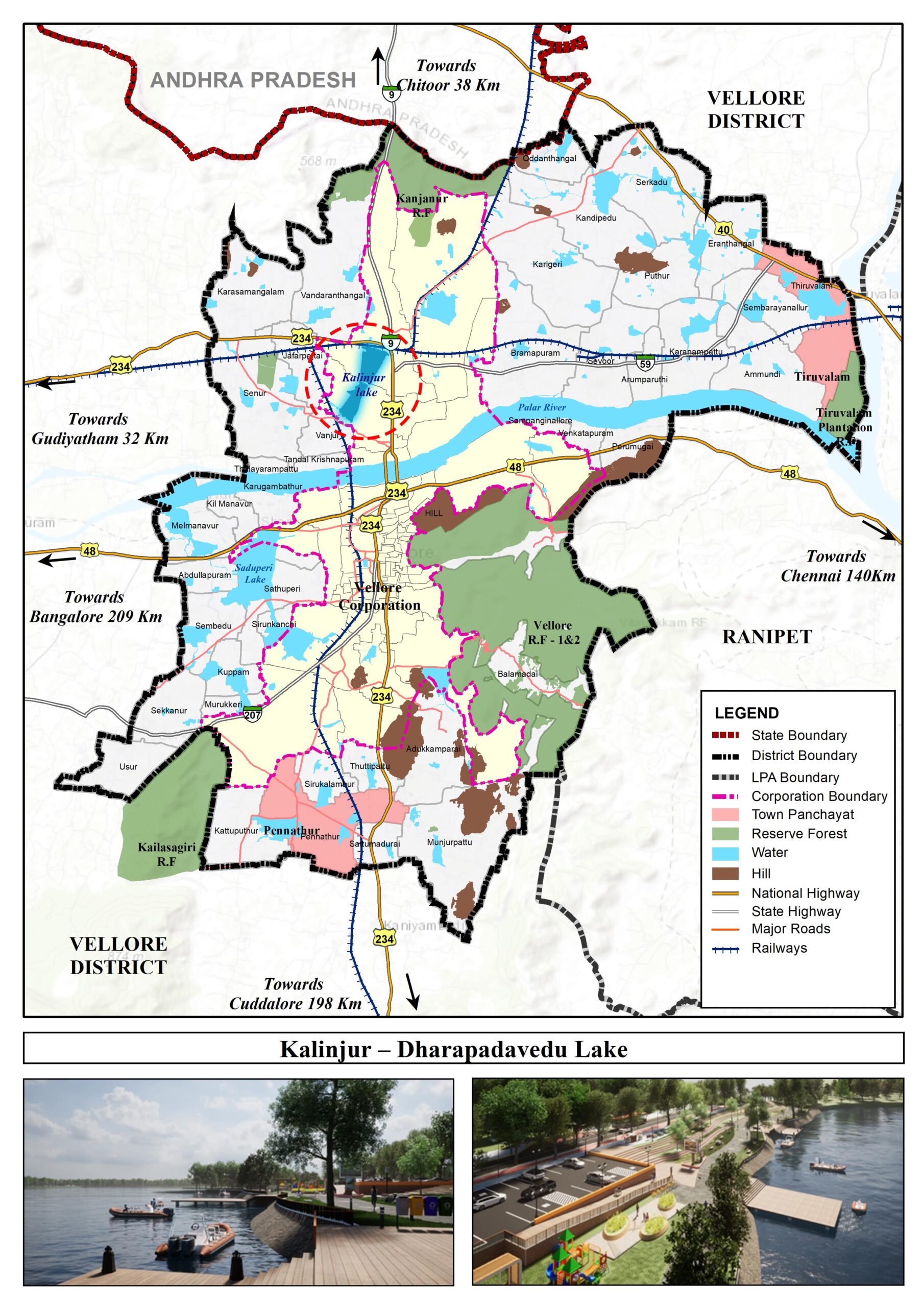
Kalinjur – Dharapadavedu Lakefront development is proposed to integrate the blue-green infrastructure, aiming to enhance environment sustainability, resilience, and overall well-being of the community.
Leather Skill Training Institute is proposed to contribute significantly to the development of skilled artisans, promote entrepreneurship, and support the leather industry.
Please click text below
The proposed Grid of Road network aims to enhance connectivity, reduce traffic congestion, and support the overall growth and sustainability of the region.
The bridge proposal not only serves as a vital transportation link but also connects the missing link of the major transportation network from Katpadi to Vellore.
The Walking Street proposal aims to transform a designated area into a lively and accessible space, fostering community engagement, supporting local businesses, and enhancing the overall urban experience.
This proposal outlines a sustainable tourism circuit designed to showcase the cultural, historical, and natural richness of the Vellore Local Planning Area.
Linking water tanks involves connecting multiple storage units to create a comprehensive water distribution system. This practice is vital for optimizing water supply, ensuring consistent access, and managing resources efficiently. Whether in residential, commercial, or agricultural settings, the linking of water tanks offers several advantages.
The afforestation of degraded urban forest in Vellore aims to rejuvenate the ecological health of the forest, enhance biodiversity, and create a sustainable green space for the community.
Repurposing old defunct quarries presents an opportunity to transform abandoned sites into valuable and sustainable assets. These Quarries are proposed as water storage reservoirs.
Saduperi Lakefront Development is proposed to conserve the lake and create a recreational opportunity in the neighborhood.
Kalinjur – Dharapadavedu Lakefront development is proposed to integrate the blue-green infrastructure, aiming to enhance environment sustainability, resilience, and overall well-being of the community.
Leather Skill Training Institute is proposed to contribute significantly to the development of skilled artisans, promote entrepreneurship, and support the leather industry.